19/10/2026
Expert responses regarding increasingly frequent and severe rainstorms
URV researchers from various disciplines answer key questions regarding the causes and consequences of the increasing frequency and intensity of storms affecting the region, its infrastructure and local communities
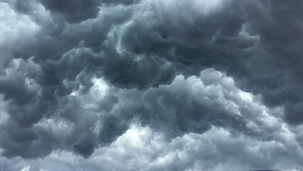
URV researchers from various disciplines answer key questions regarding the causes and consequences of the increasing frequency and intensity of storms affecting the region, its infrastructure and local communities
Javier Sigró, researcher at the Department of Geography
A member of the URV’s Centre for Climate Change (C3) specialising in the origins of meteorological phenomena and their connection to global warming.
How do such extreme storms occur?
They happen when there’s atmospheric instability, which can be caused by different mechanisms. The best known is probably the DANA [depressió aïllada en nivells alts, or isolated high-altitude depression], which brings cold air at high altitudes. If there’s also warm air at the surface, rapid cooling occurs, leading to cloud formation and, as a result, heavy convective rainfall.
And are they difficult to forecast?
It’s relatively straightforward to predict when atmospheric conditions are unstable, in other words, when conditions are right for major storms to develop. What’s far more challenging is predicting precisely when and where they will hit and how long they will remain. That kind of behaviour is inherently quite chaotic.
Are these downpours just what we’ve always had, the gota freda (‘cold drop’, a severe weather pattern driven by high-altitude cold air), or is something changing?
The Mediterranean has a long history of high-intensity rainfall events, but they are becoming more intense. For torrential rain like this to form, you need atmospheric instability, upper-level cold air and a warming Mediterranean Sea to supply the moisture and energy. That’s what makes it increasingly severe. If atmospheric circulation is also weak, storm cell clusters move very slowly, which concentrates intense rainfall over the same area and leads to massive accumulations of water. Ultimately, the Mediterranean has always had conditions that can lead to heavy downpours, but now they are being exacerbated by climate change. Experts estimate that climate change has increased the intensity of some of the more severe storms by about 20%.
Jordi Toda, researcher at the Department of Mechanical Engineering
A physicist, meteorologist and lecturer at the URV, and forecasting and monitoring specialist at the Meteorological Service of Catalonia.
How are the recent weather events we have been experiencing forecast?
Modern weather forecasting basically relies on numerical prediction models. The meteorological variables of the models, such as precipitation, wind and humidity are updated every day, which provides the baseline for weather forecasts. One of the limitations of the computer models, however, is that they output a fixed figure for each variable, whereas real-world weather forecasts are expressed in terms of probability. What we end up with is the likelihood that a particular phenomenon will occur with a certain set of characteristics.
Have the models improved in recent years?
Yes. Five-day forecasts are now far better than they were 25 years ago. Looking two or three days ahead, model reliability reaches 70, 80 or even 90 percent. The reliability is very high. But it’s true that we will never reach 100 percent. We can never be absolutely certain that a particular event will occur in a specific place or know in advance exactly what the consequences will be.
So, by its nature, forecasting is uncertain?
Correct. Uncertainty is inherent in forecasting. People often confuse uncertainty with not knowing, but they are not the same thing. Not knowing means having no idea what will happen. With a weather forecast, we know what’s coming; what we cannot pinpoint is the exact location or the precise details. For instance, we can forecast heavy downpours in the Camp de Tarragona area, but we cannot pinpoint whether individual municipalities like Tarragona, Constantí or Vila-seca will be hit. A forecast predicting heavy rain for Camp de Tarragona is still correct if the storm hits Vila-seca rather than Tarragona, since that’s well within acceptable margins of uncertainty and cannot be called ‘not knowing’.
How can we make weather warnings more effective?
One of the main objectives of weather forecasting and monitoring is ensuring the public gets messages they can understand and react appropriately to. To achieve this, I think we need a concerted effort by meteorologists to educate the general public, so people understand what key concepts like ‘risk’ entail. People often conflate risk, hazard and vulnerability. They’re concepts that get muddled together. Maybe people don’t really understand them very well. Risk, for example, is based on three key concepts: hazard, vulnerability and exposure. If you have a pool full of piranhas, the hazard is extremely high. But if you stay away from it, there’s no risk. However, if you stick your head in and expose yourself completely, risk increases exponentially.
Ferran Grau, researcher at the School of Architecture (ETSA)
A member of the URV’s Camp de Tarragona Urban Research Centre (CRUC) specialising in architectural and urban adaptation in response to climate change.
How can buildings in areas prone to torrential rain or extreme storms be retrofitted?
The first priority is to assess where the building is located, to understand its surroundings to determine whether action is necessary or feasible. For instance, if it’s near a seasonal stream, we might look into whether containment barriers can be put up to ensure safety. As for the building, the focus shifts to inspecting the roof and drainage infrastructure to make sure they can withstand severe downpours. Existing drainage systems are currently ill-equipped for extreme events, so retrofitting usually involves modifying the roof and upgrading the drainage capacity by, for example, installing larger downpipes.
And, in terms of urban planning, what measures should be adopted?
There’s clear evidence that we’ve built where we shouldn’t have, so taking a regional approach to planning before breaking ground is very important. We need to understand natural drainage corridors and not build directly on them or in wetlands. We can take concrete action right now by building large stormwater tanks, creating attenuation basins and integrating sustainable drainage systems. Simply put, we need to look at how to absorb sudden downpours into the ground, which means studying the subsurface soil profile and finding tailored solutions for each part of the city.
Fàbia Morales, researcher at the Department of Psychology
A member of the Technological Innovations in the Measurement of Latent Traits Research Group, her expertise centres on developmental and educational psychology.
How can weather warnings affect people?
When alerts are issued, some people are naturally more predisposed to feeling anxious. While anxiety is often viewed as something very negative, it can be very positive in moderation because it leads to action. For severe weather warnings, a baseline level of anxiety is actually something needed to get people to protect themselves and take precautionary measures. The issue is that we not all the same. Some people have more trouble dealing with their anxiety. They can find alerts deeply distressing, which can cloud their judgment or even prevent them from acting.
Do frequent warnings dull the public’s reaction?
This can have a desensitizing effect. For some, it can dampen the productive level of anxiety they should feel. If people take precautions but the downpour misses their area, they may start to feel those precautions aren’t really necessary. But they are necessary, because it’s a matter of risk: the storm might hit you or it might not, but you always have to protect yourself just in case. So, feeling a bit of anxiety isn’t a bad thing; it’s actually what should happen.
Is this related to understanding that uncertainty is an inherent part of an alert?
Exactly. Uncertainty has to be understood as an intrinsic part of any warning. Alerts should always bring some anxiety so people recognize the potential for it to affect them personally. It’s always better to err on the side of caution than to face the consequences of failing to take precautions.
Dani Miravet, researcher at the Department of Geography
Specialist in mobility management and planning, public and private transport systems and their relationship with land-use planning and urban design.
How do severe storms affect the rail network?
When we talk about the rail network it’s important to consider that railways are a fixed infrastructure. Trains run on fixed tracks, which means there are very few alternative routes if there’s extreme weather, unlike the road network, for instance. And in trains, there are other factors to consider: overhead lines, communication systems, electrical grids… Everything’s interconnected, so the whole network is susceptible to damage in severe weather events like these.
What about the rest of the transport network?
Other modes of transport are also vulnerable, but buses, for example, have the advantage of being able to use alternative routes. If a specific road is blocked or flooded, a bus can usually be rerouted onto another road. So overall, the disruption tends to be less severe. But, if a damaged road is the only way in or out of a certain town, the consequences extend beyond public transit and impact private vehicle use as well.
Why do some railway networks collapse during extreme weather while others hold up?
There’s no single cause. For years, Rodalies, the local commuter rail network, has suffered from chronic, long-term underinvestment, which has left its many moving parts far more vulnerable to failure when severe weather strikes. In contrast, networks that have been consistently maintained tend to be more resilient.
Pablo Girgado, researcher at the Department of Private, Procedural and Financial Law
Head of the URV’s Insurance Law Research Group and an expert in insurance contract regulation and insurance market transparency and competitiveness.
How is climate change and the increasing frequency of extreme weather affecting the insurance sector?
Recurring claims related to climate risks may affect future insurance contracts, most likely by increasing premiums. When a climate event is officially classified as an ‘extraordinary risk’, compensation falls to the Insurance Compensation Consortium (the Consorci de Compensació d’Assegurances, or CCS), provided statutory conditions are met. However, if extraordinary losses occur with increasing frequency, the public fund’s reserves deplete more rapidly, which can drive up premiums. Eventually, premiums could reach levels where coverage becomes unaffordable or insurers could refuse to offer coverage because the exposure would exceed acceptable thresholds. In that case, people could still turn to the insurance consortium, but their coverage will always be more limited.
Can insurers limit coverage or raise premiums based on the climate risk for a specific area?
Insurers naturally want to underwrite policies and cover risks, but they need to be profitable and cannot operate at a loss. Insurers can’t take on levels of exposure that compromise their economic survival. This is why the market is overseen by the Ministry of Economy’s Directorate-General for Insurance and Pension Funds. To manage exposure, insurers will either seek to redefine risk boundaries, without infringing policyholder rights and respecting express consent requirements, or raise policy premiums.
If a property is flooded several times, is each event still treated as an extraordinary event?
What constitutes an extraordinary event is strictly defined by law. In principle, the recurrence of an event does not change its legal classification. If an event legally qualifies as extraordinary, the insurance consortium provides compensation in line with statutory requirements.
Do you foresee major changes to insurance contracts in the coming years as a result of climate change?
Yes, there will be changes without a doubt. But the insurance sector is continually adapting to meet emerging needs, in this case, needs driven by climate change. As environmental risks increase, demand for insurance coverage is likely to increase.